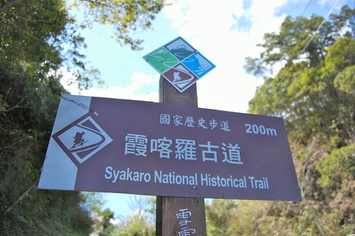
In October of last year I hiked this trail from the Qingquan side to the abandoned police station in the middle and back. This time we decided to start at the other end, at Yoro 養老, and hike to the middle and back again.
Originally the trail was built by Taiwan's aborigines. however during the Japanese occupation the trail was widen to allow supply trucks in. Along the trail many police stations were built allowing the Japanese to control the unruly local aborigines however only the foundations and a few walls remain.
We set off early from Taipei and followed the number 3 to the turn off for Neiwan. Passing through Neiwan we continued up and into the mountains. The roads were mostly in good condition until the last turn off and then we were driving on rock, dust and soil.
We set off early from Taipei and followed the number 3 to the turn off for Neiwan. Passing through Neiwan we continued up and into the mountains. The roads were mostly in good condition until the last turn off and then we were driving on rock, dust and soil.

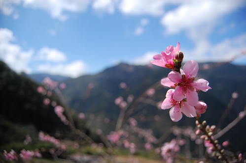
The trailhead starts at an area called Yoro 養老, there's not a lot here so we bought everything we needed before this point. About 10 minutes into the walk and we came across a small farm that was growing cherry blossoms for some reason. I hadn't imagined that there was a market for growing and selling these trees but it looked very nice anyway.
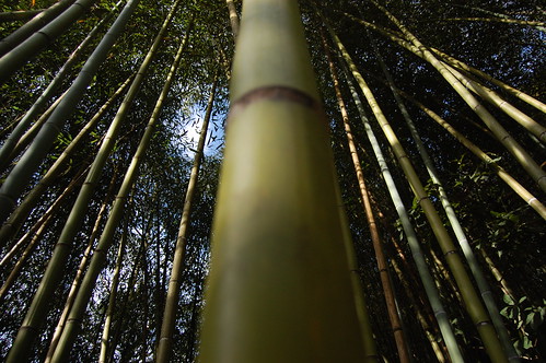
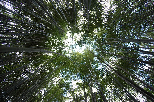
Further down the trail we passed through several sections of bamboo forest. This was the first time that I've seen this kind of bamboo growing in this quantity and it was an amazing sight. Though a little eerie when the wind picks up and it starts to bang together!
Along the route we passed several abandon police stations that the Japanese built, however as these were usually made from mud and stone there really isn't much left to see apart from the foundations.

About 5km in and we came across the first big landslide. There is a path that leads down the middle of the landslide but really you should take the path to the right, skirting around it. At the bottom we should have crossed over the dry riverbed but as we were following my map we continued on the old trail along the river only to get stuck at a collapsed bridge. We followed the river back down and met a some people who dispatched their 8 year old daughter to guide us back to the trail. Slightly embarrassing, especially considering how obvious the trail actually was!
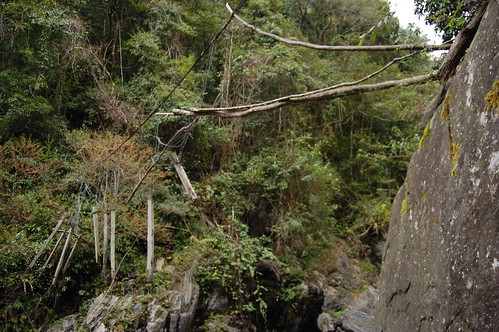

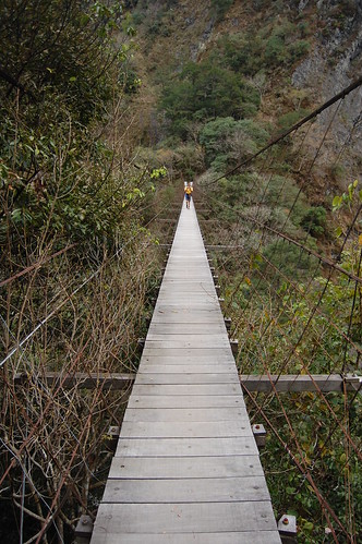
From here the trail continues as normal with a few wooden bridges and more landslides. And after another 4km or so we arrived at the Baishi suspension bridge 白石吊橋. It's huge. 145m in length and I would guess at least 100m above the river valley. It is amazing to think that back in the day the Japanese would drive their supply trucks over it. Just walking over it scared the hell out of me!
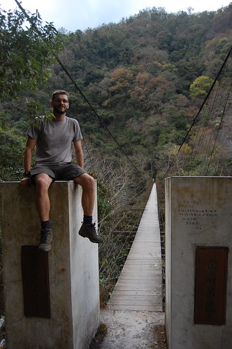
On the other side there are 2 trails, the one to the left going down to the river valley where some people were camping and the one to the right leading up to the Baishi police station. The trail here becomes very steep and it was knackering walking up it.
After an hour we arrived at the police station and set up camp for the night. We were here only 4 months ago and it's amazing to see just how much the building has deteriorated in such a short time. It seems lots of people who go up there pull the walls apart for firewood. Pure madness, the building is in the forest and so it's surrounded by wood. And Taiwan is such a young and modern country that there's not that much history here and for people to burn it is just inexcusable.
After an hour we arrived at the police station and set up camp for the night. We were here only 4 months ago and it's amazing to see just how much the building has deteriorated in such a short time. It seems lots of people who go up there pull the walls apart for firewood. Pure madness, the building is in the forest and so it's surrounded by wood. And Taiwan is such a young and modern country that there's not that much history here and for people to burn it is just inexcusable.
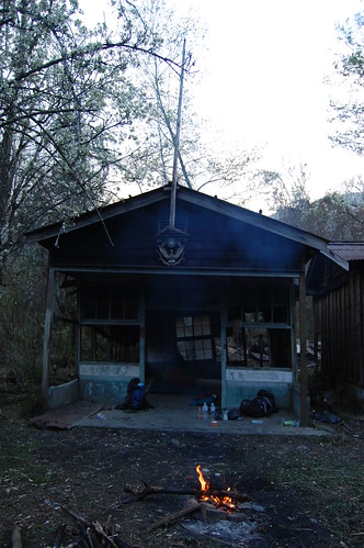
We made a small fire and cooked up some food. It was quite freaky at night as we could hear all sorts of animals crawling around in the forest and on top of the police station and none of dared go out to see what they were.
In the morning we got up early and hiked back along the trail. It took about 5 hours to hike in but only 3 and half to get out.
Photos of this leg of the trip (Yoro to Baishi) are here
For photos from the first time I came here (Qingquan to Baishi) have a look here
Practicalities
The trail runs from Qingquan to Yoro but there's no public transport to either side, so we did it in two sections however it would be possible to do it in 3 days returning to the same starting place. Or another alternative would be to do it on bicycle.
There are lots of places to camp if you don't make to you destination and there are a few streams to collect water from too but they are not always very reliable.


Hey Stu,
ReplyDeleteI'm not sure if you remember me or not. This is Carrie. I met you through Scott.
I'm glad to see that you've finally started a blog to showcase your photography and love of Taiwan. I find it hard to drop by everyone's photostream on Flickr, so your blog provides good reading material over my lunch hour. Happy trails. I'm looking forward to reading about more of your adventures.
I hope you're still submitting your photos to Taiwan Photographers.
I'm looking for writers who are interested in writing about Taiwan/hiking/photography for my other site at www.myseveralworlds.com
Let me know if you're interested. Cheers!
Hi Carrie, sorry for the late reply. My internet has been down for a few months now and I've only just got it sorted out! Glad you like the blog and I'd love to write something for your site. Let me know if you have something you in mind. Thanks.
ReplyDelete