Usually when I go hiking I have a pretty good idea of what the trail is like and the route that I'm going to take. However sometimes that isn't the case and I go somewhere on a wing and a prayer. Zhuzishan 竹子山 was one of those hikes.

I went to Qixingshan 七星山 not very long ago and from the peak I spotted Zhuzishan. I don't really know how to explain this but sometimes I just see a interesting or beautiful looking mountain and that makes me want to climb it. So I got out my map and found a route, the Zhuzishan old trail.
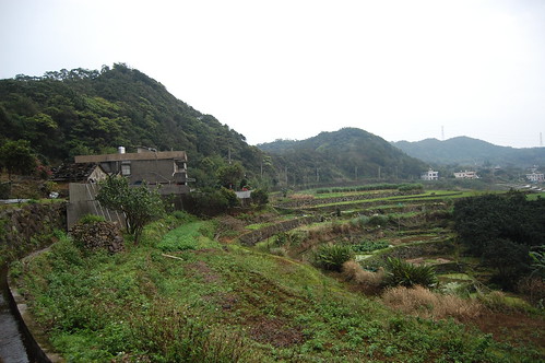
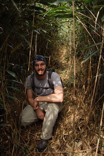
The trail head isn't easy to get to and driving is the only real option. It starts in a village called Daozhaohu 倒照湖. The initial trail went up gently and wasn't very demanding, apart from a lot of sliding around in the mud!
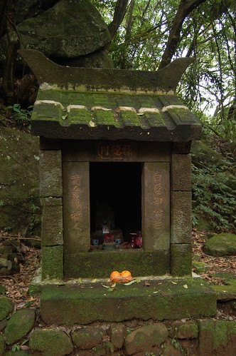
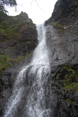
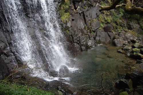
After a while we came to an Earth God temple 土地公廟. From here the trail splits in two and we headed up to the right towards the Alibang waterfall. Again the trail was very easy going and although there are a number of side trails, there are signs to direct you too. After about 30mins or so, we reached a point where we could get a glimpse of the waterfall and it was impressive.
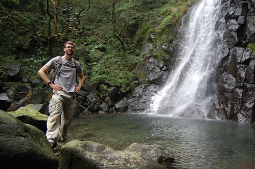
We carried on and eventually the trail met up with a river which we walked up for about 100m until reaching the waterfall. The waterfall itself seems to have 2 parts and a small pool at the bottom; in the summer this would be a great place to cool off.
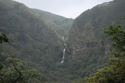
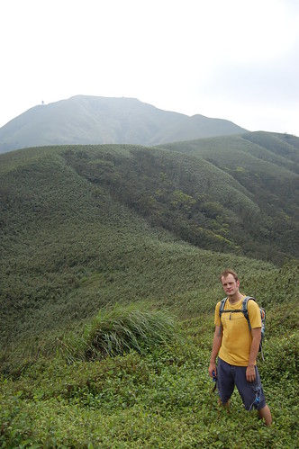
The hike up to this point had been easy, however, it was soon to unravel! According to my map there's a trail on the opposite side of the river that leads up, around the top of the waterfall and onward to Zhuzishan. We found the trail easily enough and headed up. From here it was tough going, very steep and slippy and there were no fixed ropes. Towards the top we got some really nice views back towards Jinshan and the coast.

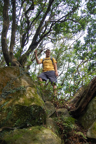
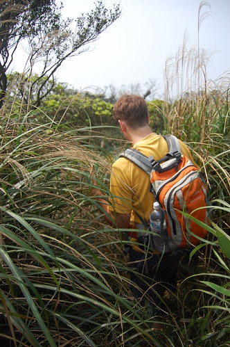
Once the trail begins to level out, the vegetation changes completely. Lots and lots of arrow bamboo 簡竹. It was really difficult to see the path as the bamboo is incredibly thick. In some parts it was taller than we were and it was more like crawling through a bamboo tunnel!
The forest briefly changed again and at this point there was a fork in the road. Straight on led to another waterfall, but we didn't head that way and instead we went left towards Zhuzishan and more bamboo.
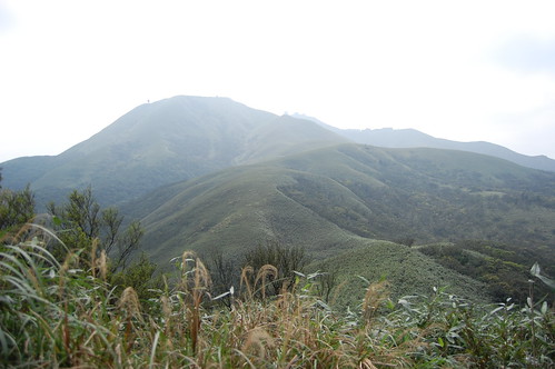
Eventually, after a struggling through the bamboo we reached a clearing and got some great views of the surrounding mountains. From there, the trail headed down and then disappeared suddenly. We spent about half an hour just crawling around inside the forest of bamboo trying to find the path. It's like a maze in there and it's so easy to get disorientated. And after giving it our best shot we just had to give up.... it seems the path on my map no longer exists... bugger!

So we headed back down. There is actually another path by the Earth God Shrine and I suspect that one leads to Zhuzishan without going to the waterfall, maybe next time! And in despite of the fact that we never made it to Zhuzishan, this was still a fantastic hike and I'll definitely be going back to try out that other path sometime.

More pictures here
Edit - We did eventually go back to follow the other path and again the trip was unsuccessful. We followed it up for at least an hour when suddenly the trail got really thick with vegetation and became incredibly steep. Threee minutes later and we bumped into a couple of Taiwanese guys who were trying to hack their way through to forest with machettes. We passed them but there wasn't a trail anynore and we were just aimlesly crawling through the jungle; no choice but to turn around. However the two Taiwanese fellas said that there might be a path in three months time.... I suspect not though!
Practicalities
We drove up Yangde boulevard and followed the road signs for Jinshan. After going over Yangmingshan and then heading down we took a left turn at a bridge called the Sanhe brdige 三和橋. This small road leads into a farming area and there are lots of other small roads leading off the houses and the like. Stick to the biggest looking one and cross over two more bridges. The trail head is next the No.47 house in Daozhaohu 倒照湖. Walk past the house and look for the plastic tags on the right.
The walk to the Alibang waterfall is pretty easy and anyone could do it. As for getting to Zhuzishan..... maybe I'll find out next week!
The map below doesn't lead to the trail head but just the Sanhe bridge, you'll need to go further to get to the start.


u got some really awesome pic in ur blog mate, keep up the walks and keep posting!
ReplyDeleteThanks! I will do!
ReplyDeleteHi, great blog, I only just discovered it today!
ReplyDeleteIt's good to know there's an easier way to one of my favorite Yangmingshan places, Alibang Waterfall (I've seen the trail turnoff while hiking Zhuzishan Old Trail, but never followed it: getting to the waterfall along the other route, from the opposite side was (as you mention) so difficult it put me off trying this other way). A branch of the path you took after visiting the waterfall eventually descends to Tudigong Ling, near Chingshan Waterfall to the north).
I'm surprised Jhuzishan Old Trail wasn't passable when you went: I've been twice (although admittedly a couple of years ago now) and I was told the trail has become more 'popular' (relatively speaking!) than in the past. The problem later on is finding the path, as you say, because it's very hard going (and extremely steep(!), but when I went there was always a visible trail at ground level and loads of plastic streamers to give clues to the route; it was just very, very slow going. The trail ends at the huge square radar on Zhuzishan North Peak, and a big fence covered in razor wire. Probably you were unlucky and no one had been through for awhile to waymark the route. This happened to me on my last trip to Datun Stream Old Trail (another fantastic walk if you haven't taken it yet, and more often walked than the tougher Zhizishan Trail); the way up the side of the crater below the summit was completely overgrown and really tough to get up: every time in the past it had been a wide 'freeway' of a trail!
Keep up the blog (and thanks for the book plugs), it's a great read!
Richard (Saunders)
Hi Richard,
ReplyDeleteGlad you like the blog. I've actually moved it over to wordpress now www.hikingtaiwan.wordpress.com
The last time I went to Zhuzishan, it was really overgrown but the two guys hacking their way through seemed to think they'd have the trail recut in a couple of months so it 'should' be ok now! When you're in thick bamboo like that it is very easy to miss a tag and wander off in the wrong direction though.
I'll definitely have a go at Datun Stream, I think my friend has mentioned it to me before but we haven't got round to going there yet. Climbing the side of an old crater sounds really cool! Especially with the news suggesting that Datun may become active again.....
Stu